Water situation snapshots
Select snapshot
Water temperature situation
 Send your observations
Water temperature 8.10.2026
Temperatures of inland waters continue to decline
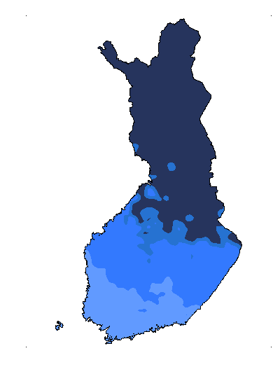
At the end of September and in early October, the temperatures of inland waters have continued to decline as is typical of the autumn, but they have mostly remained above the seasonal average. On Thursday 8 October, the temperatures were 9–13°C in the southern and central parts of the country, 8–10°C in North Ostrobothnia and Kainuu, and 5–8°C in Lapland. The difference to the long-term average was mainly 0–3°C, but in Lauritsala, Lake Saimaa, surface water was 3.9°C warmer than usually this time of the year. The warmest water was observed in Lauritsala, Lake Saimaa (13.2°C) and the coldest in Kukkolankoski, River Tornionjoki (5.4°C). According to water system forecasts, surface water temperatures will continue declining as the winter approaches.
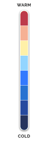
The surface water temperatures are measured at the depth of 20 cm at 8 in the morning, during open water season. The measurement points are usually close to the shore. Temperatures are representative of these locations and cannot be applied to larger areas. You can view the latest observations on the water temperature map (in Finnish). Everyone can also record their own observations, making them appear on the map. The Finnish Environment Institute does not verify these observations. You can observe the general development of surface water temperatures by the colours on the map.
Further information
- Estimate of water temperature on a map (in Finnish)
- Measuring the temperature of water systems (in Finnish)
The information on this page was produced by the Finnish Environment Institute (Syke).

How is surface temperature of water measured?
The surface temperature of water varies significantly depending on the season and weather. Temperatures are measured daily in lakes, rivers and the sea during the ice-free season, and the results are available without delay.
Lakes and rivers
The surface water temperatures of lakes and rivers are measured at 34 monitoring stations, and temperature data are available from 80 sites in total. The measurements come from automated instruments placed at the depth of 20 centimetres close to the shore, and the results are available in almost real time. The official reference value is the reading recorded every day at 8:00 a.m.
Marine areas
At sea, surface water temperatures are measured from a depth of 20 to 30 centimetres using buoys. Water temperature data are also obtained from sea water level monitoring stations which operate round the year. Their measurements are taken at a depth of two to three metres, however, and the results cannot be compared to the readings from the buoys.


