Water situation snapshots
Select snapshot
Ice thickness

 Send your observations
In addition to point-like observations, the ice situation map shows the estimates calculated by the forecast model. You shouldn't go to the ice based on the map estimates alone, because the local variation can be big! Especially immediately after freezing, the ice can be much weaker in currents and backwaters than, for example, in coastal areas. In spring, when the snow has melted, the sun can make even the thickest ice brittle in just a couple of hours.
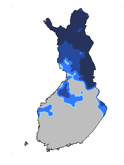
Ice situation 31.5.2026
The season for ice thickness measurement has ended
The ice thickness measurements for the winter season 2025–2026 have ended, and the monitoring will continue in late 2026. The shorelines of the most recent active measurement site, Lake Kilpisjärvi, have melted, which is why the measurement can no longer be carried out safely. As a result, the ice thickness can no longer be measured, and the ice thickness measurement season has reached its end. As the spring comes and the sunlight and warmth increases, the thickness of the ice no longer indicates its load-bearing capacity, and the ice becomes brittle. This may cause even seemingly thick ice to be deceptively weak.
The Finnish Environment Institute updates the estimate of the ice situation on this page three times a month. The estimate is based on ice thickness measurements at 46 observation sites in different parts of Finland. The ice thickness is measured approximately on the 10th, 20th and 30th day of every month.
You can view the latest observations on the ice situation map. Anyone can record their own ice observations, in which case they will be shown on the map, but the Finnish Environment Institute does not verify these observations. You should not go on the ice solely based on the estimates and observations on the map because ice quality and thickness vary greatly between different water bodies and even within the same lake.
You can observe the general development of the ice situation by a computational estimate of ice thickness, i.e., the colours on the map. The estimate is made by modelling, and it utilises ice thickness observations as well as weather data and forecasts, for instance. It is not possible to determine the actual ice thickness of any waterbody based on the ice situation map. The ice thickness observations are only representative of the specific site on the date of the measurement and are therefore indicative and cannot be extrapolated to large areas.
Further information

Stay safe on ice from autumn till spring
If you intend to go out on ice, you should always make sure that it is strong enough on the route you intend to take. Get to know the properties of ice in different seasons and pay attention to possible hazards.
Autumn ice
The water starts freezing in autumn when its surface temperature drops below zero. Shores and bays are the first to freeze over, while any deep areas and places with a current get their ice cover last. It is typical for ice thickness to vary in different areas of a lake or the sea in autumn. Measure the thickness of the ice on your route to be sure that it will carry you. Transparent clear ice must be at least five to ten centimetres thick before it carries a person walking on it.
Spring ice
As the air grows warmer and the sun’s radiation becomes stronger in spring, the snow and ice cover starts to melt. Once the snow is gone and solar radiation starts melting the ice, its structure becomes more fragile and cavities appear in the ice layer, and you can no longer conclude the bearing strength of the ice by measuring its thickness. Even if it were 20 to 30 centimetres thick, the ice can be too fragile to carry the weight of a person.
Hazardous areas
Particularly hazardous areas are straights, deep areas and places with a current, including at river mouths and near springs, sewers and stormwater drains, where the ice may remain thin throughout the winter. You should also monitor the ice thickness near large stones, docks and other structures as well as aquatic plants. Shipping lanes, and cracks and holes cut in the ice, are dangerous even in mid-winter. Snow cover makes it more difficult to spot areas of weak ice.

